Southern Québec

Populatie
View all studies on the map
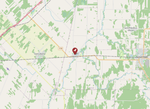
Map of Southern Québec, Canada
© OpenStreetMap

Details

Land
Canada
Soort
Tree swallow
Pipeline
Nee
Lopende periode
2004–Present
ID data
Metal rings
Individuele data
Morphological measures
Parasites data
Basale broeddata
Ja
Voederdata beschikbaar
Nee
Download metadata
Geen data beschikbaar
General Information 
Responsible partyCentre de Recherche en Écologie de l'Université de Sherbrooke
ContactCarolyne Houle (carolyne.houle@usherbrooke.ca, ORCID: 0000-0002-3393-864X)
OrganisationCentre de Recherche en Écologie de l'Université de Sherbrooke
Other team members

Dany Garant (dany.garant@usherbrooke.ca)

Fanie Pelletier (fanie.pelletier@usherbrooke.ca)

Marc Bélisle (marc.m.belisle@usherbrooke.ca)

Data availabilityno data available through SPI-Birds
Data license 
Funding 
Study site 
NameSouthern Québec
IDSQB
CountryCanada
Size (ha)1,020,000
Major site changes 
Latitude (decimal degrees N)45.6516
Longitude (decimal degrees E)-72.6926
Minimum elevation (m) 
Maximum elevation (m) 
Number of nests (min) 
Number of nests (max) 
EUNIS habitat codeE: Grasslands and lands dominated by forbs, mosses or lichens | E2: Mesic grasslands | E2.1: Permanent mesotrophic pastures and aftermath-grazed meadows | A: Marine habitats
Description of study site 
Data 
SpeciesTachycineta bicolor
Start year2004
End year 
Continuous collection of dataYes
Gap years 
Longest data collection 
Taggingmetal leg ring
Brood data collectedbrood size, clutch size, clutch type, fledge date, fledgling number, hatch date, lay date
Individual data collectedimmigration status, age, parasites, size (weight, wing, tarsus, etc.), plumage characteristics
Environmental data collected 
Genetic data collected 
Experimental manipulations 
Description of experimental manipulations 
Other activities 

Details

Land
Canada
Soort
Tree swallow
Pipeline
Nee
Lopende periode
2004–Present
ID data
Metal rings
Individuele data
Morphological measures
Parasites data
Basale broeddata
Ja
Voederdata beschikbaar
Nee