Why do farmland birds thrive in intensive flower bulb cultivation? Spatial analysis of landscape structure and breeding bird densities
Why do farmland birds thrive in intensive flower bulb cultivation? Spatial analysis of landscape structure and breeding bird densities
Terrestrial EcologyContact Person:
Droevendaalsesteeg 10
6708 PB Wageningen
Are you a bird- and/or data-nerd? Or just interested in bird ecology, GIS, agriculture and possibly flower bulbs? We are looking for a motivated student who is interested in a combination of spatial ecology, farmland birds and landscape-scale biodiversity patterns. You will work on an exciting case study that dives into the paradox that farmland bird populations in flower bulb cultivation perform very well against all odds.
The paradox
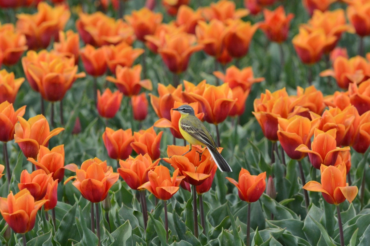
Where biodiversity loss has on average been halted in nature reserves, biodiversity in rural areas keeps declining. This internship/thesis focuses on the Dutch Flower Bulb Region, an intensive agricultural landscape that is generally assumed to support relatively low biodiversity. Surprisingly, densities of several farmland breeding birds appear to be comparatively high in this region relative to national trends, despite intensive land use and high pesticide application. This apparent paradox forms the core of the project. Luckily, we possess long-term datasets to investigate this paradox.
Landscape composition and effects on density of breeding birds
We think that the relatively high density of birds can largely be explained by the unique landscape structure of this region, which is characterized by open fields, dense ditch networks and small field sizes. These features may create favourable conditions for breeding birds such as Yellow wagtail, Grey partridge and Skylark. To test this, we use a long-term dataset on breeding birds (BMP) and farmland birds (MAS) and combine this with public available landscape configuration data to create habitat associations of five species of birds. We will compare the Flower Bulb Region to other open farmland areas in the Netherlands and make comparisons with historical data. This project is part of an ongoing PhD study and contributes to understanding how agricultural landscapes can be managed to enhance biodiversity (for the project see: www.Livinglabb7.nl).
What you will do
- Process and analyse spatial ecological datasets;
- Derive landscape metrics using GIS;
- Perform statistical habitat analyses;
- Interpret ecological patterns;
- Contribute to a scientific publication as co-author.
Application
If you are interested in this project, please contact Hugo Langezaal, PhD-candidate at the Terrestrial Ecology department of the Netherlands Institute of Ecology. H.langezaal@nioo.knaw.nl
- Type of work: Spatial analysis (ARCGIS/QGIS), data analysis and statistical analysis + reporting;
- Level: MSc/HBO;
- Location(s): Wageningen and/or partially working from home;
- Duration: 3-6 months, preferably from March/April – July. Suitable for a thesis and/or internship;
- Some experience with GIS (QGIS/ArcGIS Pro) and spatial analysis software is required;
Some affinity with ecology and possibly (farmlands) birds is positive.