Bagley Wood

Populatie
View all studies on the map
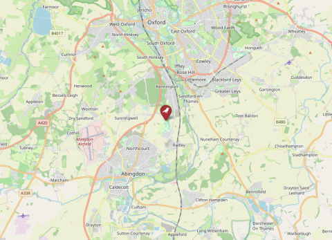
Map of Bagley Wood, United Kingdom (OpenStreetMap).

Details

Country
United Kingdom
Species
Great tit
Pipeline
No
Max. nr nestboxes
515
Running period
2007–2014
ID data
Metal rings
Tags
Habitat
Mixed
Basic breeding
Yes
Winter data
Winter ringing
Feeding at nest data
No
No data available
No data available
General Information 
Responsible partySimon Evans
Contactsrevans@me.com
OrganisationUniversity of Exeter
Data availabilitynot available via SPI-Birds
Data licenseby permission of data custodian
Study site 
NameBagley Wood
IDBAG
CountryUnited Kingdom
Size (ha)226
Major site changes 
Latitude (decimal degrees N)51.70
Longitude (decimal degrees E)-1.25
Minimum elevation75
Maximum elevation125
Number of nest boxes (min)510
Number of nest boxes (max)515
EUNIS habitat codeG4.F: Mixed forestry plantations
Description of study site

Nestbox density varies across the twelve, spatially separated nestbox areas: high (~8 per hectare) or low (~2 per hectare).

Habitat quality, in terms of dominant canopy species also varies: high (oak dominated) and low (conifer dominated).

https://doi.org/10.1111/1365-2656.12008

Data 
SpeciesGreat tit
Start year2007
End year2014
Continuous collection of dataYes
Gap years 
Longest data collection8
Taggingmetal leg ring, transponders, PIT tags fitted in some years, winter tagging
Brood data collectedbrood size, clutch type, fledge date, fledgling number, clutch size, hatch date, lay date
Individual data collectedage, size (weight, wing, tarsus, etc.), ventral plumage reflectance
Environmental data collectedvegetation
Genetic data collected 
Experimental manipulationsyes
Description of experimental manipulations 

Details

Country
United Kingdom
Species
Great tit
Pipeline
No
Max. nr nestboxes
515
Running period
2007–2014
ID data
Metal rings
Tags
Habitat
Mixed
Basic breeding
Yes
Winter data
Winter ringing
Feeding at nest data
No